


Antique Mid-Atlantic Pictorial Map | Wooden Puzzle of District Columbia, Maryland and Delaware
Antique Mid-Atlantic Pictorial Map | Wooden Puzzle of District Columbia, Maryland and Delaware
- Regular price
- Price: $95.00
- Regular price
- List Price: $115.00
- Sale price
- Price: $95.00
- Unit price
- per
Key Features:
Key Features:
- Premium Quality: Crafted from durable 3mm (.14in) composite wood board for lasting enjoyment.
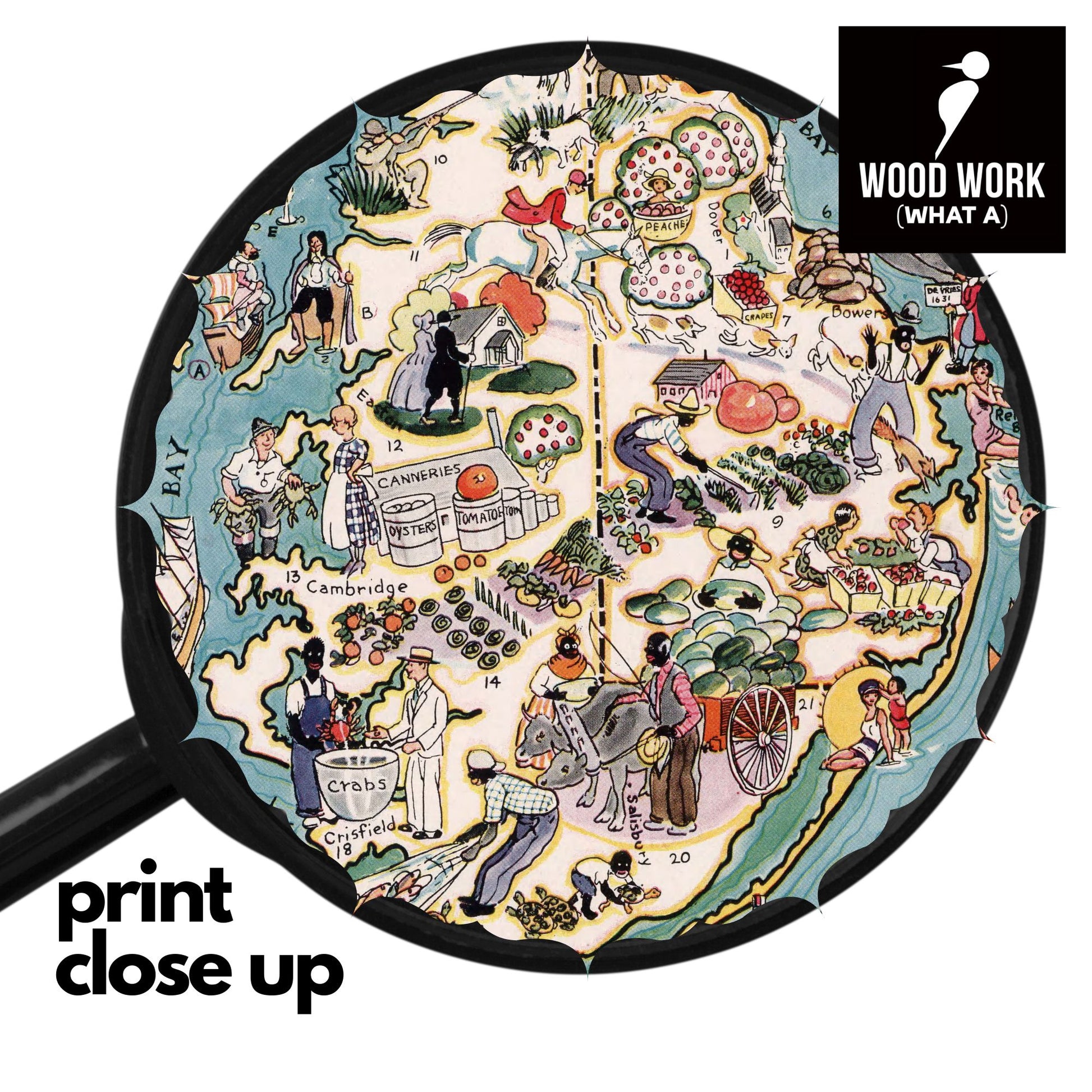
- Vibrant Imagery: High-resolution UV printing directly on the wood—no paper laminate—for stunning detail and vibrant colors.
- Eco-Conscious: Made with environmentally friendly materials.
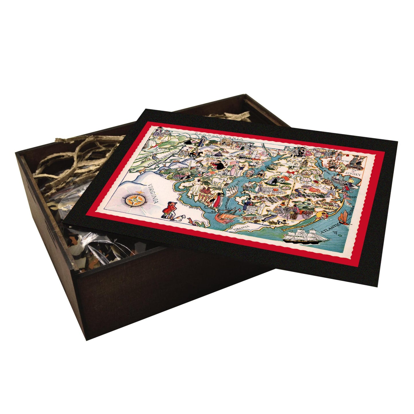
- Heirloom Keepsake: Your puzzle arrives beautifully packaged in a handcrafted wooden box, perfect for gifting or storing your masterpiece.
Craftsmanship and Care:
Craftsmanship and Care:
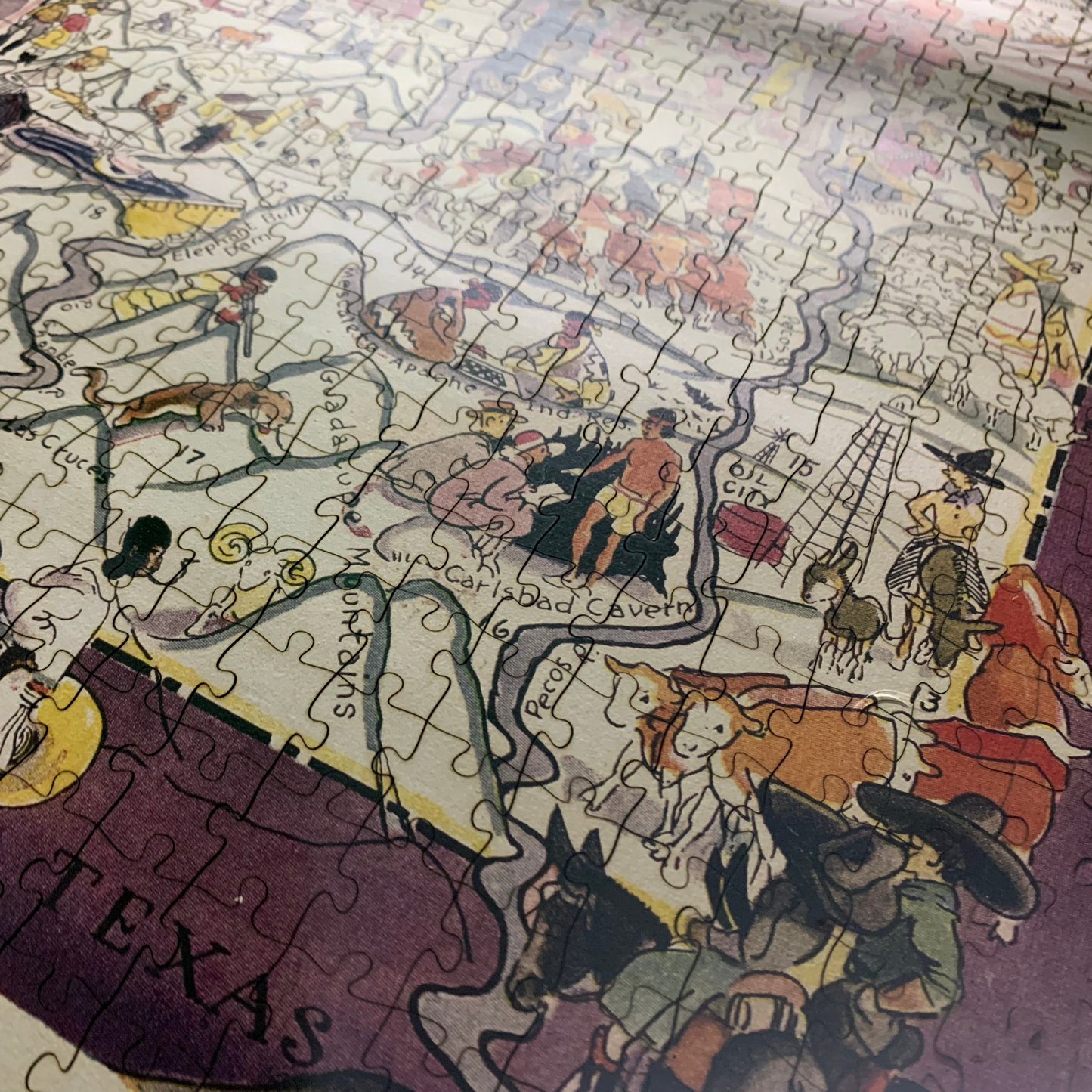
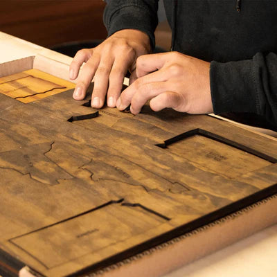
Experience the satisfying click of perfectly interlocking pieces. Our state-of-the-art laser cutting ensures precise fit and a smooth, seamless puzzle-solving experience. The perfect upgrade from cardboard without breaking the bank.
- Natural Laser Residue: A small amount of harmless black residue from the laser cutting process may be present. Simply wipe it away with a damp cloth.
- Hand-Finished Details: Each puzzle board, each wooden box are all carefully hand-stained, painted, and glued.
Satisfaction Guaranteed:
Satisfaction Guaranteed:
We are confident in the quality of our puzzles. If you are not completely satisfied, we offer a full refund or exchange.
PLEASE NOTE:
Each puzzle is crafted to make the most of your chosen size. Artwork may be subtly adjusted to meet our material and production standards while honoring the original work. Planning to frame yours? Email info@whatawoodwork.com for final measurements.
Couldn't load pickup availability
In stock
 PRODUCT DESCRIPTION
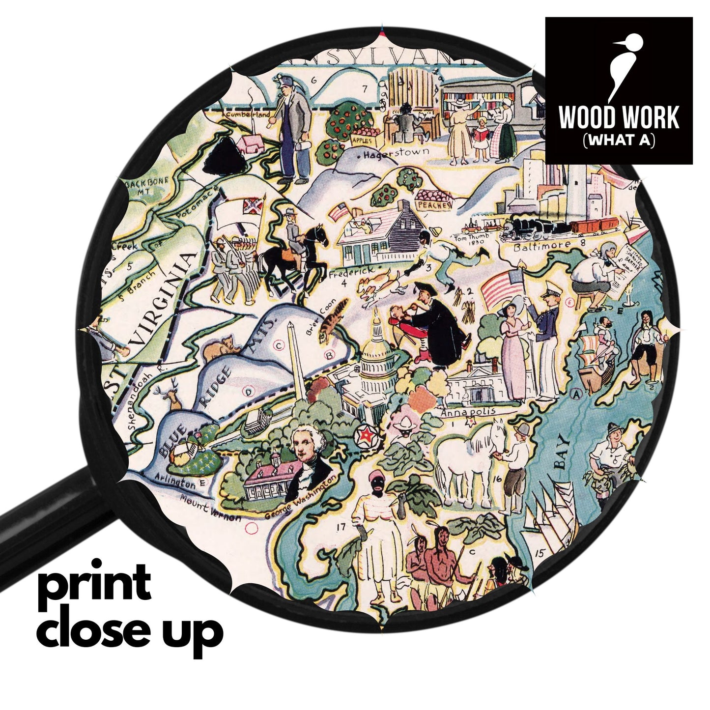
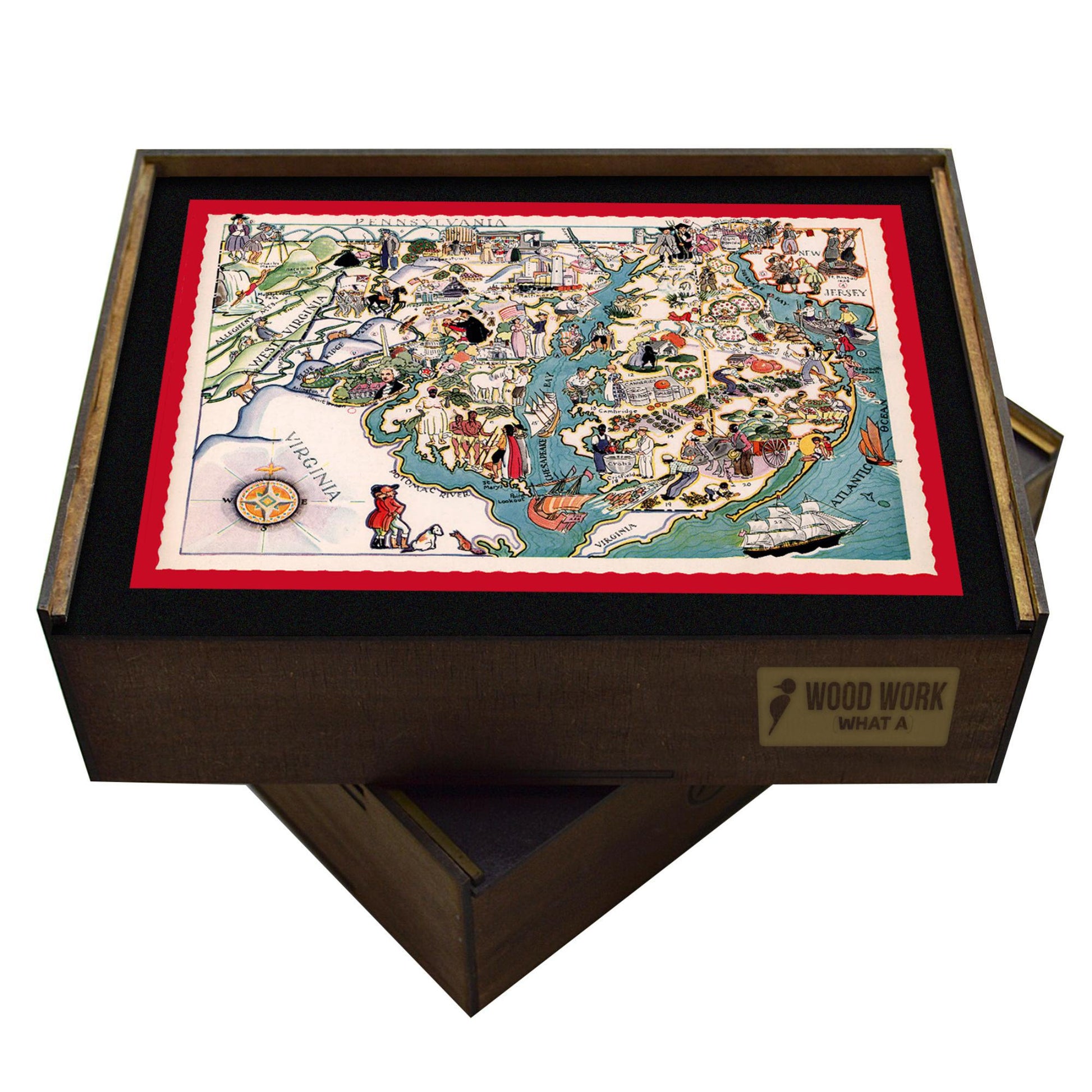
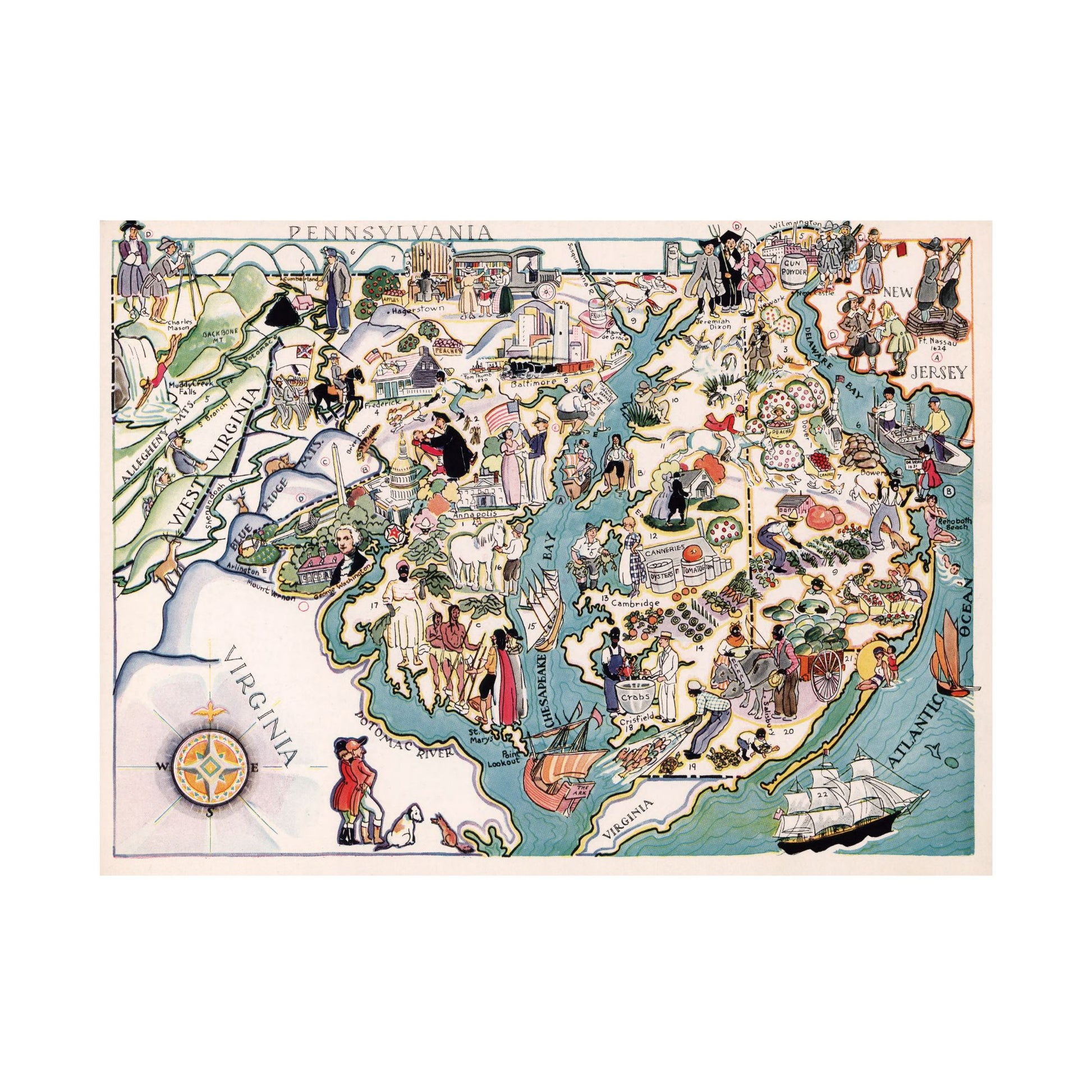
Vintage Mid-Atlantic pictorial map, 1940s style. Hand-drawn illustrations of landmarks, regions: Pennsylvania, New Jersey, Delaware, Virginia, West Virginia. Colorful, whimsical art.
Capture the charm of the mid-20th century with this vintage pictorial map of the Mid-Atlantic region. Featuring hand-drawn illustrations of landmarks, historical figures, and regional culture, this map is a delightful blend of art and geography.
Explore the heart of the Mid-Atlantic with this map's captivating depiction of iconic landmarks. From the bustling port of Baltimore to the historic charm of Cambridge, and the natural beauty of the Allegheny and Blue Ridge Mountains, each location is brought to life with engaging illustrations. Discover the Chesapeake Bay, a hub of maritime activity, and trace the path of the Potomac River as it winds its way to the Atlantic Ocean. This map is a visual journey through the region's rich history and diverse attractions.
These vintage illustrations from the 1900s by Berta and Elmer Hader reflect the artistic style and cultural perspectives of the time. While some depictions may reflect outdated stereotypes, we appreciate the Haders' work for its historical value and the charming details that capture aspects of each state's life and landscape. From bustling towns to iconic landmarks, these illustrations offer a window into a bygone era of American life.